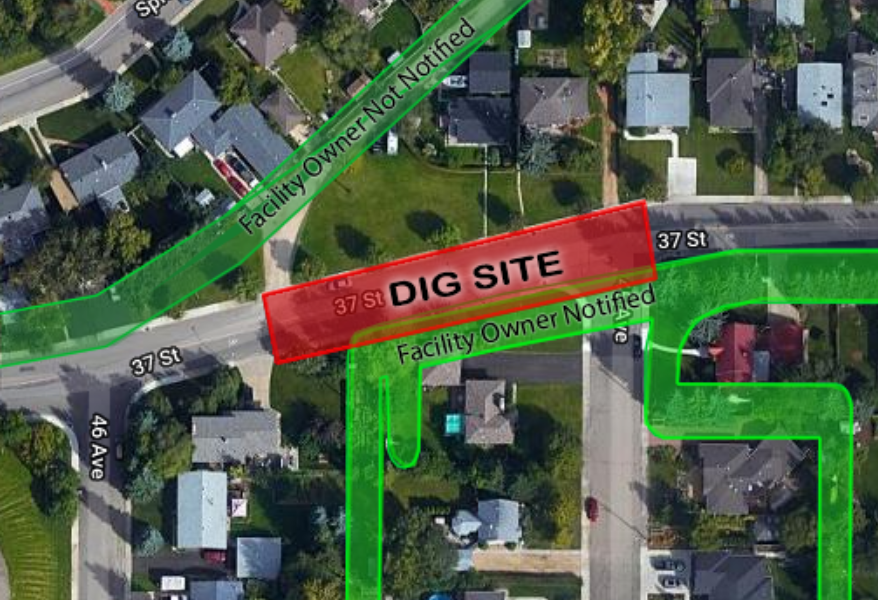
Alberta One-Call’s system determines which facility owners need to be notified based on the work area the excavator draws on the system map.
Facility owners registered with Alberta One-Call (AOC members) supply the locations where they need to be notified of a proposed ground disturbance. This is called member data and it is plotted on the system basemap. The dig site for each locate request is also plotted on the basemap. Whenever the mapped dig site overlaps with member data, that member company receives a locate notification.

If AOC members are receiving locate notifications for areas that do not affect their underground infrastructure, they can adjust their member data to more precise locations. Member data can be supplied in one of two formats:
Polygon Data is comprised of GIS shape files representing the precise locations of underground infrastructure. Whenever the mapped dig site overlaps with the locations in the GIS shape files, the member company is notified.
Grid Data is comprised of the legal land description locations (quarter sections) the underground infrastructure runs through. Whenever a dig site is mapped within one of these quarter sections, the member company is notified.
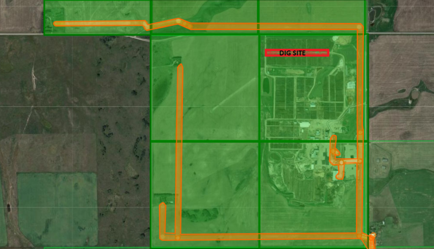
The below image illustrates the difference between Polygon Data (in orange) and Grid Data (in green). If the AOC member supplies Grid Data, they receive locate notifications for all mapped dig sites that overlap with the green area. If that same AOC member supplies Polygon Data, they only receive location notifications for mapped dig sites that overlap with the orange areas. The precise locations within the Polygon Data eliminate unnecessary locate notifications for areas that do not affect the underground infrastructure.

For more information about supplying Polygon Data, click HERE.
If you have questions about your member data, or would like to learn more about submitting an update to reduce unnecessary notifications, email info@albertaonecall.com with the subject line "Polygon Data Enquiry".
Kassi Zaba