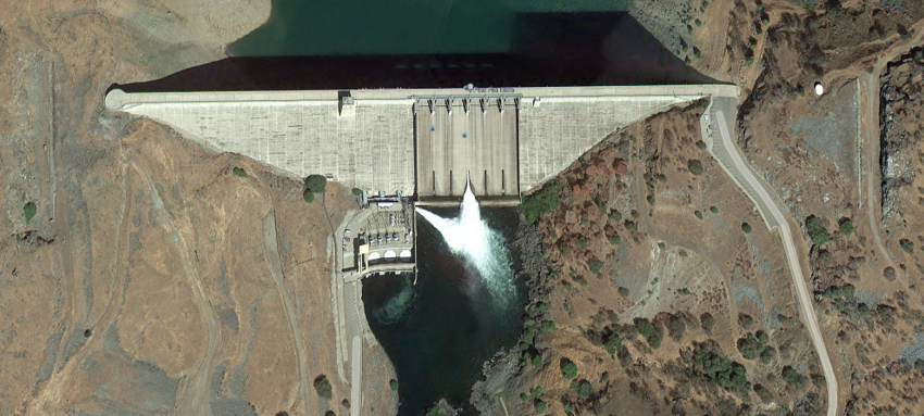
The April “Where in CA is This?” had several winners, some of whom wish to remain anonymous, correctly identified the gorgeous aerial view that included Pine Flat Reservoir and Dam, the surrounding Sierra Nevada foothills, and KRCD's Jeff L. Pine Flat Power Plant at the base of the dam. The image was a screen capture from the Kings River Conservation District on LinkedIn. In addition to the masked mappers, one of whom said “I looked in Google Earth. Most of the concrete dams are built with arches. This one is not.” Which I found to be quite interesting. Here is a more overhead view:
 |
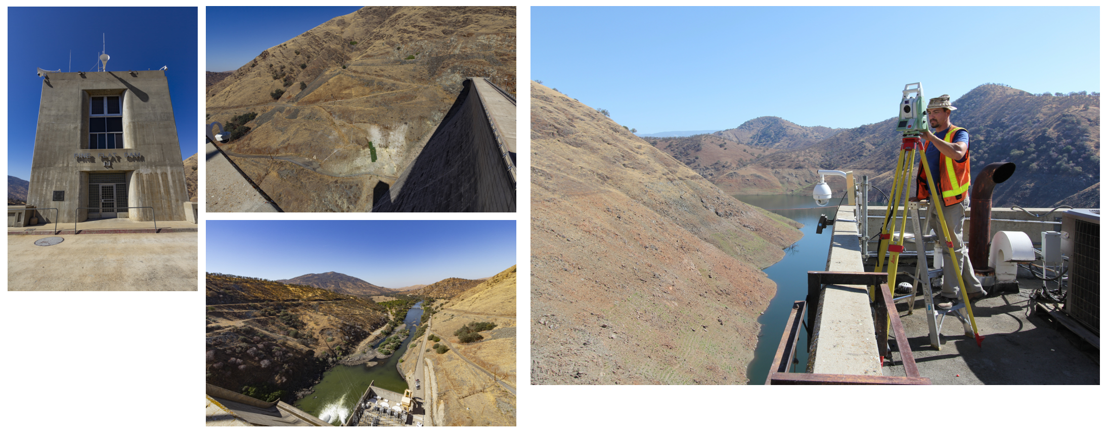
Bob DeWitt had “Just a hunch and confirmed on Google Earth.” Marta Alvarez identified it “From the internet dam photos … never been there.” Bill Tuck said “I recognized that this month’s photo looked like the foothills to the Sierras so I went on Google Earth and I believe this is Pine Flat Dam. As for last months photo, I thought it might be the center of Nevada but I couldn’t find any photos of it online. That’s (Nevada Center) a pretty cool monument.” Steve Martin recognized it as “Pine Flat Dam. I've seen that photo somewhere before.” The local knowledge winners were Harry Jayne “Pine Flat dam. Fished there my whole life. Fishing now in Idaho.” and Tim Odom, PLS of Provost & Pritchard Consulting Group who said “The photo this month is of Pine Flat Dam and Reservoir, in eastern Fresno County. I’ve had the pleasure of performing several surveys at (and on) this dam for Kings River Conservation District, who operates the power plant there. We were surveying the steep slope above the power plant and this (on top of the tower) seemed like the most appropriate place for a setup. That’s me in October of 2014.”
If you have a distinctive photo of California you would like to share, please send it to Rob with details of the location.
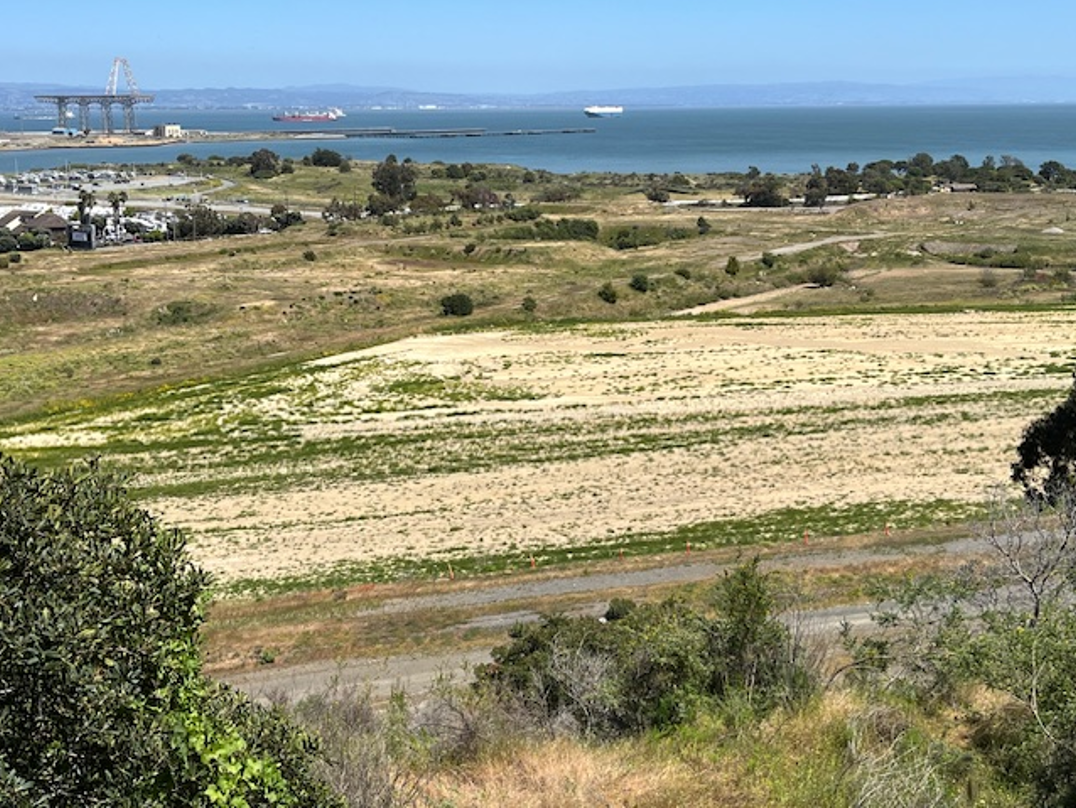
Try to identify the location of this month’s photo. Please tell me how you identified the location. Submit answers or submit your photo of a special location in California to: Rob McMillan